
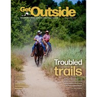
Federal, state, and local fire agencies are using several mitigation strategies in the face of more extreme wildfire events and growing wildland-urban communities
By Taylor O'connor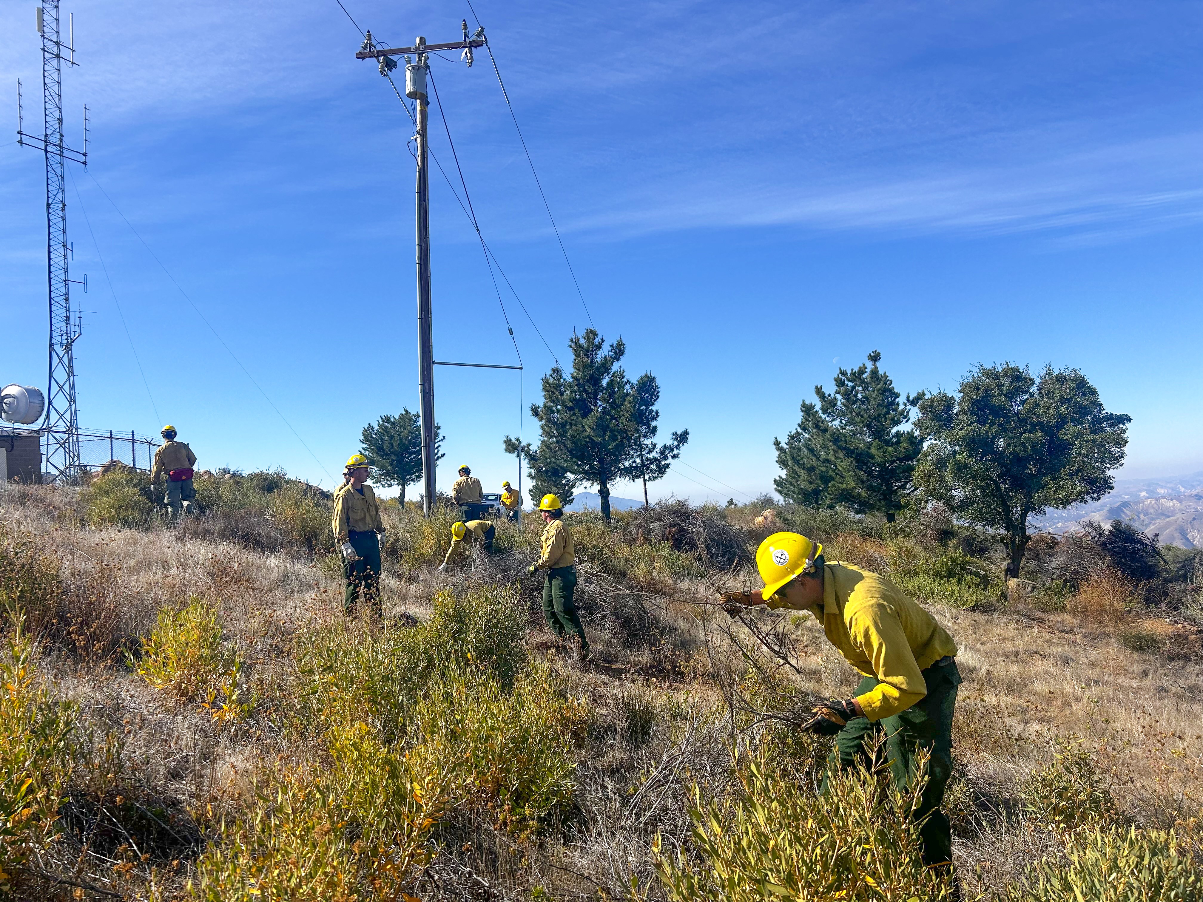
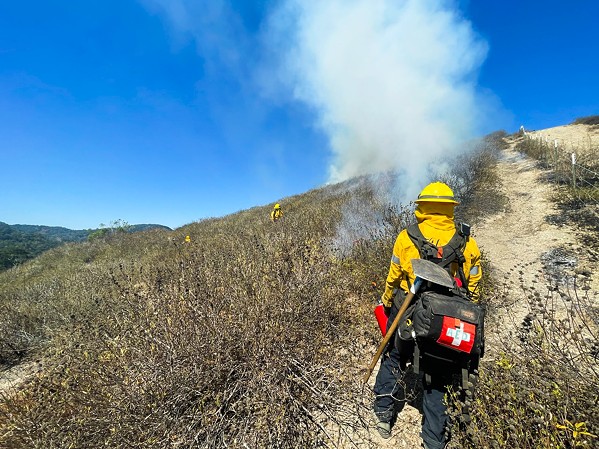
PHOTO COURTESY OF LOS PADRES FOREST SERVICE
Los Padres Forest Service rangers remove brush and vegetation near La Cumbre Peak off Camino Cielo Road, north of the city of Santa Barbara.
[


      {
        "name": "Promo Temp Targeted",
        "id": "PromoTempTargeted",
        "class": "inlineCenter",
        "insertPoint": "4",
        "component": "15511697",
        "requiredCountToDisplay": "0"
      },

      {
        "name": "Ad - Medium Rectangle CC01 - 300x250 - Inline Content",
        "class": "inlineCenter",
        "insertPoint": "8",
        "component": "15582119",
        "requiredCountToDisplay": "12"
      },{
        "name": "Ad - Medium Rectangle LC01 - 300x250 - Inline Content",
        "class": "inlineCenter",
        "insertPoint": "18",
        "component": "15582122",
        "requiredCountToDisplay": "22"
      },{
        "name": "Ad - Medium Rectangle 9 - 300x250 - Inline Content",
        "class": "inlineCenter",
        "insertPoint": "28",
        "component": "15582121",
        "requiredCountToDisplay": "32"
      }]
Tepusquet Canyon residents Lilian and Dave Clary loaded their mules and other livestock into trailers and fled their home after receiving an evacuation order in 2017.
"[Dave] left at 10 a.m., by 2:30 p.m. we could see flames on the western ridge of the canyon and watched the crews fighting fires, the helicopter drops, the big tankers, it was amazing," Lilian Clary said. "One evening we were watching with binoculars and it looked like a huge bed of charcoal on 50 to 60 acres just glowing."
Alamo Fire flames would later engulf their backyard and more than 28,000 acres in Santa Barbara and San Luis Obispo counties, she said.
Watching the fire sweep through the west side of the canyon, which hadn't burned in 50 years, showed Clary what a prescribed burn could have done—taken out brush and vegetation to help prevent severe future fires, she said.
"I'm not speaking for all my neighbors. I know I have neighbors wary of controlled burns, but [to me] they just make sense," she said.
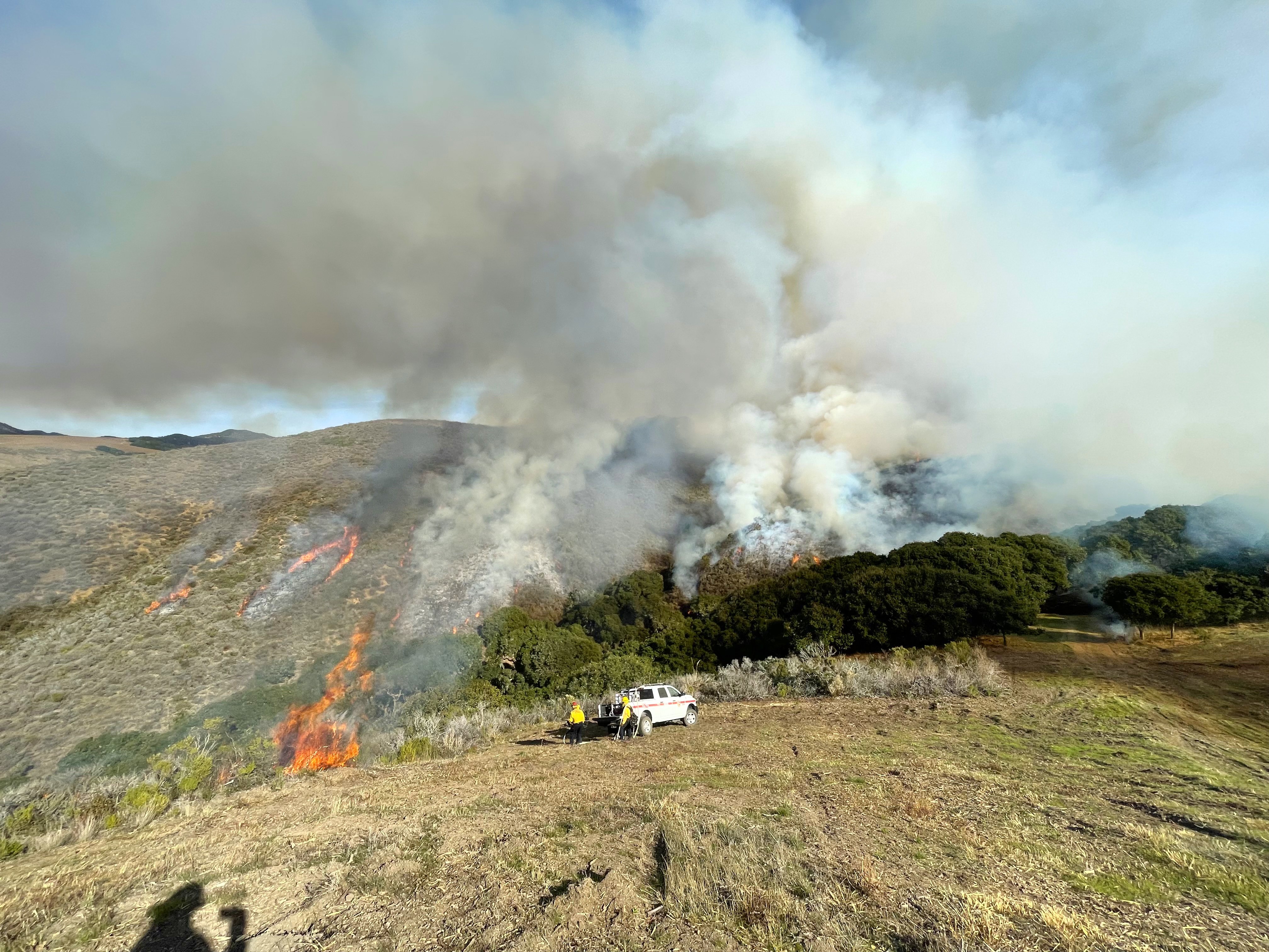
Prescribed burns occur when crews apply fire to selected land parcels to remove overgrown vegetation or invasive species—referred to as fuels—as a way to reintroduce fire to fire-adapted ecosystems after years of fire suppression activities in the forest, to maintain soil and forest health, and to prevent high-severity fires in the wildlands and in communities.
To prevent future high intensity fires, the Los Padres Forest Service—alongside local and state fire agencies—are building up their fuel reduction programs as part of a solution to protecting wildlands on the Central Coast and the growing wildland-urban interface communities, which are facing hotter, longer wildfire seasons and more extreme climate events.
"Fire is a natural part of the environment, and fire suppression has led to this fuel build up and that's what we're trying to do through this emphasis of fuels management," said Los Padres Forest Service Forest Fuels Planner Rodolfo Uribe. "We do these projects to prevent catastrophic fires or reduce [their] impact."
To support these efforts, the U.S. Forest Service received $5.5 billion in funding from the federal Bipartisan Infrastructure Law to help with work in the Los Padres 1.75 million acres, and Cal Fire dedicates millions of state dollars in grant funding each year to conduct fuel reduction work.
Some environmental organizations are concerned with fuel management's environmental impacts and would like to see more investment in building homes with fire-retardant infrastructure. But Uribe and other fire agencies said that these efforts are beneficial in the long run to keep wildlands thriving.
"If we get a big fire, it's going to shut down the forest, destroy the trails. It has a huge impact on the community," Uribe said.
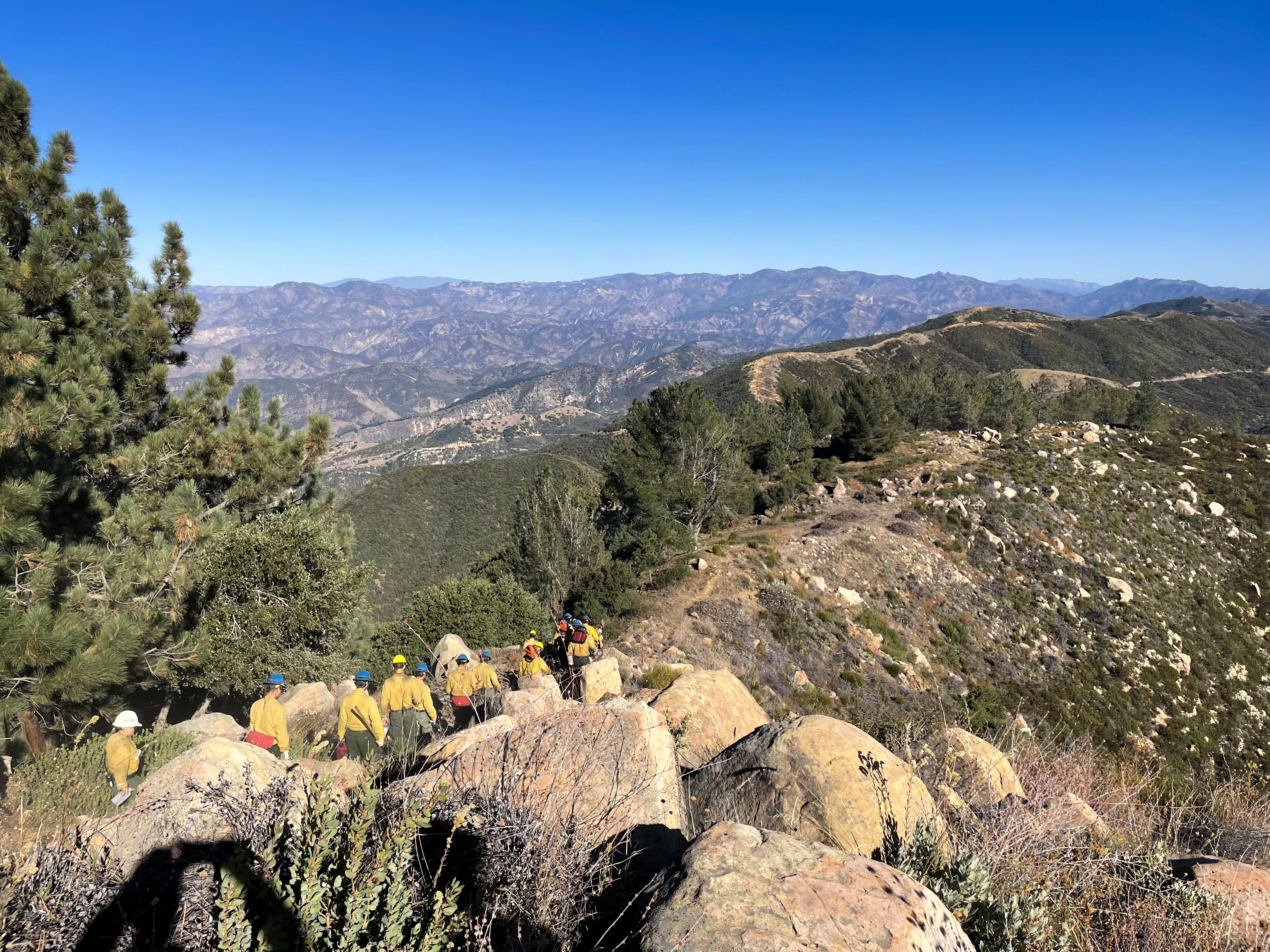
Projects underway Los Padres National Forest crews have spent days at a time in the Big Sur area, removing chaparral and vegetation by hand or with handheld equipment as part of the Strategic Community Fuelbreak. The vegetation removal project is approximately 525 acres and designed to protect communities on Mount Manuel's west side (near Pfeiffer Big Sur State Park) from any fires in the Ventana Wilderness, Ivor DeManty said.
"We have an increased wildland-urban interface, we have a lot more ownership adjacent to the forest. That being said, when we do have the occurrence of a fire, the risk goes up and we're trying to protect these homes," said DeManty, a U.S. Forest Service battalion chief and assistant district fire management officer.
The 24-mile project runs along the coastal ridgeline of Skinner Ridge, Mount Manuel, and Post Summit from Bottchers Gap to the Big Sur River, according to the project description. Any removed vegetation will be piled for future burning or chipped and spread.
"The placement of the fuel break is one where they were looking at past fires and what ridges have been routinely opened up during fire suppression activities," DeManty said. "[Fuel breaks] help with defense and help with firefighter safety. If we can put a fuel break in ahead of time and have that defensible line available, then not only does it save money, it potentially saves lives, homes. It's kind of a balance."
The Strategic Community Fuelbreak is one of 26 fuel reduction projects in Los Padres National Forest that are either being conducted or under National Environmental Policy Act review—which analyzes a project's environmental impacts by identifying threatened or endangered species, heritage sites, and/or natural resources that may be impacted by the project, Los Padres Deputy Fire Chief Seth Mitchell said.
Smoke, air quality, botany and wildlife, powerlines, and highways and railway systems running through the forest are other factors that go into planning a prescribed burn. The Forest Service analyzes fire history records and fire perimeter data to see where certain efforts have worked along ridgelines.
"Today, we know that fire is a natural part of western ecosystems. We know that Native American Groups throughout the western United States have used fire for their cultural resource benefit," Mitchell said. "We're trying to get back on track, but it's a challenging new world: communities, powerlines, all this infrastructure we need to mitigate in this process. The world is more complicated now than it was 200 years ago."
From 1910 until the 1970s, Los Padres exclusively suppressed fires in the forest, the forest's Public Affairs Specialist Andrew Madsen said. Years of fire suppression allowed chaparral and other vegetation to thrive when they might have otherwise been tamped back by natural fires.
"The Forest Service managed one of every five acres in the state of California. As communities continued to pop up and expand adjacent to the national forest system land, there was a very high priority for putting them out as quickly as we could to reduce impact," Madsen said. "Today in California, generations of aggressive fire suppression have left many areas unburned for decades, allowing for dangerous fuels' accumulations that contribute to much larger wildfires."
Fuel breaks vs. home hardening Wildfires are larger, hotter, and last longer than they used to, and California wildfire season is evolving into a year-round constant, Deputy Fire Chief Mitchell said.
"The extended fire seasons are definitely a challenge, and we're doing the best we can to move funding and resources ... . Each year presents a different challenge," he said.
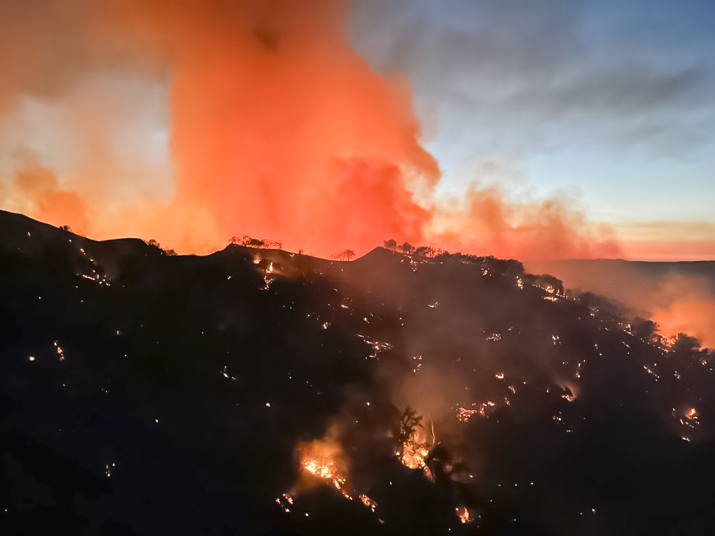
The 2017 Alamo fire was considered the state's most severe wildfire in recent history, but the Thomas Fire changed that when it burned more than 280,000 acres between 2017 and 2018 in Ventura and Santa Barbara counties.
Between 2020 and 2021, California saw some of its largest fires in state history. The 2020 Creek fire burned more than 379,000 acres across Fresno and Madera counties and in Sierra National Forest, according to Cal Fire data.
The 2020 August Complex fire obliterated more than 1 million acres across seven counties and through Mendocino, Shasta-Trinity and Six Rivers national forests, and destroyed 935 structures. The 2021 Dixie fire burned through more than 960,000 acres across five counties and through Lassen National Forest, destroying multiple communities, more than 1,300 buildings, and parts of Lassen Volcanic National Park.
"This year, California experienced a normal fire season ... It was pretty quiet in comparison to the last five years, so we were able to get a lot of work done, but it's really a lot of strategic planning and [flexibility] across all agencies to move people and funding in the right direction," Mitchell said.
Approaching each project by looking at the landscape, rather than district boundaries, is one strategy the Forest Service is trying to implement through the Wildfire Risk Reduction Project, Forest Fuels Planner Uribe said.
"Rather than zoning in one specific project, you can zoom out and see how fuels mitigation might work over entire landscapes by taking into account the different topography and fuel types," Uribe said. "It wouldn't break down by district, but by vegetation, terrain and local ecosystems. ... Fuel breaks and ridgelines don't know boundaries and changes in jurisdictions. "
Formerly known as the Ecological Restoration Project, the Wildfire Risk Reduction Project proposes prescribed burning and vegetation removal in four of Los Padres' five ranger districts, which stretch across Monterey, San Luis Obispo, Santa Barbara, Ventura, and Kern counties.
The project's original design included work on 200,000 acres—making it one of the largest projects in Los Padres. But Uribe said that the Forest Service cut back the project's acreage after a further scoping analysis was conducted. As of Jan. 11, no new footprint has been established.
Several local environmental organizations are against this project and believe fuel reduction work is the wrong approach to wildfire mitigation.
Los Padres ForestWatch, an environmental nonprofit based in Santa Barbara County, has filed several lawsuits against Los Padres National Forest for its fuel reduction projects, including the Wildfire Risk Reduction Project. The environmental nonprofit is facing off against the Forest Service in the 9th US Circuit Court of Appeals for a lawsuit against the Reyes Peak Health Project—which proposes to remove chaparral and trees across 755 acres of Pine Mountain.
As of Jan. 18, the project is awaiting funding and the court did not put an injunction on the Los Padres Forest Service while the lawsuit plays out, allowing the Forest Service to begin work once a funding source is identified.
"What it comes down to is there's a core tenant of our perspective, which is to protect communities from wildfires you have to start in the communities and work your way out from there," said Bryant Baker, ForestWatch's director of conservation and research. "The prevailing management paradigm is to start in the wildlands out in the backcountry and work your way to the communities."
He'd like to see Congress invest more into home hardening programs that help homeowners retrofit or build their homes with fire resistant materials to prevent damage or destruction in the case of wildfires.
"The reason fires burn homes are embers, generally miles ahead of the firefront and under extreme wind conditions. Embers enter a town when fires are miles away," Baker said. "They quite literally get sucked into houses, into vents, homes start igniting and start blasting their neighbor's house with embers. There's no fuel management that will prevent embers from entering town."
Installing double-pane windows, ember-proof screens on vents, and using fireproof materials on roofs are ways to keep embers from entering a home and protect it from wildfire, he said.
"Policy and legislation dumps more money into the exact same approach that we as a society have been taking for decades," Baker said. "It's crucial to create new pipelines to give communities the resources they need for home hardening programs and alert systems."
Wildland-urban interface Several communities have taken home hardening and creating a defensible space into their own hands.
Tepusquet Canyon residents—who live in the wildland-urban interface—created an informal phone tree network 20 years ago to help improve communication during emergencies, Tepusquet resident Renee O'Neill said.
"Those days we didn't have reverse 911, we didn't have any alerts that we have now through the Office of Emergency Services, or the local alerts from readysbc.org or that kind of thing," O'Neill said. "There were some harrowing experiences, but thankfully they developed the reverse 911 system, and we continued with our phone tree captain list."
The phone tree network had contact information for every resident in the canyon and broke down into "micro communities," she said. Each micro community had a phone captain who would contact 10 to 12 people during emergencies to inform them of a fire's location or evacuation area.
Residents used the phone tree network in 2008 to warn residents of the La Brea fire, which started at 2 a.m. about a mile away from the Highway 166 side of the canyon, O'Neill said.
"I had my master list, and then [the fire department] alerted the rest of the community to wake up and pay attention," O'Neill said.
Over the years, the phone tree list has been developed to show which families have young children, individuals who have disabilities, people who can't drive, and the number of structures on each property—which has been shared with the Santa Barbara County Fire Department, she said.
On her own property, O'Neill said she's added high pressure fire hydrants and sprinklers on her roof. Her adobe home and steel roof are fire resistant. She also has a backup generator in case the power gets cut off and extra food and water in case she can't leave her property.
"I'm very pro doing anything we can do to mitigate these wildfires that happen in the summertime," O'Neill said. "[Prescribed burns] promote a healthier environment. The thing that concerns the heck out of me is when we do nothing, we get these raging fires like the Thomas Fire that came through in Southern California and burned all the way from Ojai to the Santa Barbara coast."
In Cambria, residents formed the Cambria Forest Committee to discuss fuel reduction projects, defensible space, and home hardening practices, Cambria resident Crosby Swartz said.
"We're acting just like a forum for people to discuss things," Swartz said. "It's a matter of encouraging people to become aware of what people should be doing to reduce the fire danger."
Swartz installed metal screens in his filters to prevent embers from blowing into his home, and every year, ensures that he meets the required 100-foot clearance around his home by pulling invasive weeds and brush and planting trees.
"We own some forested property, and of course, it's our responsibility to maintain it in healthy and safe condition. We do most of the work ourselves, a lot of it is easy—pulling out flammable and invasive brush," he said. "You don't see immediate results, but after a few years it's amazing the difference it makes. It seems like it's an impossible task to improve what's growing in the forest, but after years it does make a difference."
Swartz said that he'd like to see a more selective approach to removing vegetation, by focusing on the dead plants or invasive species, and a stronger push for home hardening programs.
"Bryant Baker has done studies that show just blind fuel reduction of any kind of tree doesn't make a difference in fire behavior, whether you have thinned the forest or not," Swartz said. "If you have a hot windy fire, it doesn't even get slowed down. That's why it's important to focus on the house because it's been shown to work."
Protecting communities Fuel breaks aren't designed to stop a wildfire independently; rather, they are meant to help give firefighters a safer place to work from, said Rob Hazard, the Santa Barbara County Fire Department's division chief and fire marshal.
"More efforts across the state have really shifted to the wildland-urban interface that are really adjacent to our communities," Hazard said. "For our organization, that is the vast majority of the work that we do."
Vegetation management crews will go out to wildland-urban interface communities in the unincorporated parts of the county to remove chaparral or trim shrubs around clusters of homes and clear vegetation off public roads and driveways to meet Cal Fire's 100-foot clearance requirement for defensible space, he said. The county also introduced sheep and goat grazing as part of its fuel reduction work in grassland areas.
Santa Barbara County Fire conducts this work as a contract county with Cal Fire, where it oversees and manages the state-owned land (known as a state responsibility area) in Santa Barbara County. The state fire agency provides project funding through grants, which other agencies can apply for to conduct projects in their jurisdictions.
"It's in everybody's interest to help the forest to become more responsive to the local community," Hazard said.
Facing growing wildland-urban interface communities, County Fire takes a multi-pronged approach to protecting communities, including prescribed burns, home hardening education, and defensible space practices, County Fire Capt. and Public Information Officer Scott Safechuck said. The county also works with the Forest Service to address communities near Los Padres.
"It's a holistic approach to what the communities should do during a wildfire or if it's applicable to other events," Safechuck said. "We're not trying to enforce laws of defensible space for the sake of doing it. There's a safety impact; if a fire event comes through and destroys a community, there's life-impacting events that can occur."
Cal Fire oversees similar work in SLO County and approximately 1.4 billion acres of land where the state agency is responsible for emergency response and conducting vegetation management projects like prescribed burns and fuelbreaks, said David Erickson, a Cal Fire forester.
"We work with landowners located in our state responsibility area that are interested in conducting vegetation management projects—anything from creating a shaded fuel break or prescribed fire on their property," Erickson said. "We are looking at the projects on a large scale and incorporating protection of homes into what we're doing."
All vegetation management projects follow environmental guidelines and wildfire history, and they are designed to mimic natural fires, which are beneficial to protecting wildfire-prone areas and promoting native vegetation, Erickson said.
Cal Fire may get mixed reviews from residents, but when teams begin working on one property owner's land, neighbors will often follow suit after seeing the complete work, he said.
"Our vegetation management projects are scientifically and ecologically centered and mimic natural fires—which are essential to increase biodiversity [and] protect firefighters—and result in the modification of existing fuels to reduce large fire events and promote native vegetation," Erickson said.
While these projects are mainly focused on protecting wildland urban interface communities, they can also bring benefits to hikers and outdoor enthusiasts by improving habitat and preventing wildfires—which can close down trails and parks for the long term and negatively impact the environment, he added.
"Treatment may not look pleasing and you're not going to appreciate that on your hike, but six months later after rain you'll have grass growing, fruiting from plants—which will attract a whole suite of birds and animals," Erickson said. "Ultimately, these projects can enhance recreation opportunities."

Latest in Get Outside
-
Get Outside - Summer/Fall 2024
Jul 18, 2024 -
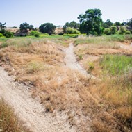
FEATURE: A long-standing trail use conflict erupts along the Salinas Riverbed in Atascadero
Jul 18, 2024 -
TRAILBLAZING: A national park near you
Jul 18, 2024 - More »
More by Taylor O'connor
-
Lake Fire burns more than 38,000 acres, Nipomo base camp remains open
Jul 18, 2024 -

GEARHUB: Take the plunge
Jul 18, 2024 -

TRAILBLAZING: Local, outdoor rock climbing spots
Jul 18, 2024 - More »
