California has been trying to build a continuous trail along its coast since the 1970s
By Camillia Lanham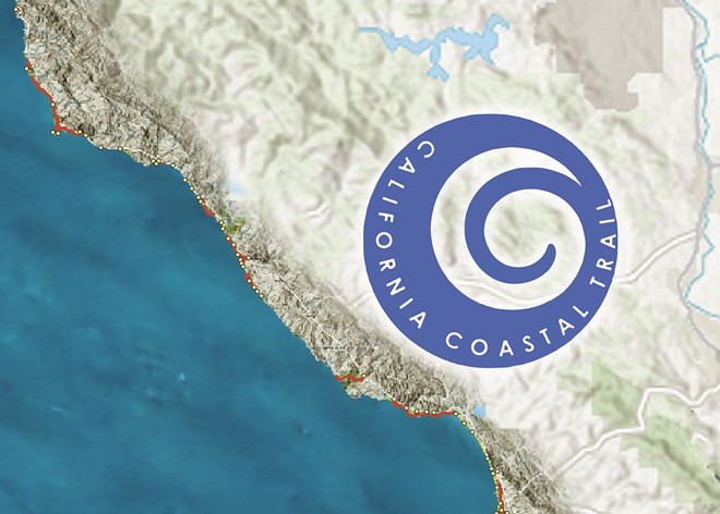
MAP CREATED BY ALEX ZUNIGA USING THE COASTAL TRAIL INTERACTIVE MAP VIEWER
Map it out Find a California Coastal Trail segment near you by visiting the-california-coastal-trail-1-coastalcomm.hub.arcgis.com. There you will find an interactive map that highlights where the trail exists and where it’s missing. Get Outside re-created this map of SLO and Santa Barbara counties using the Coastal Trail Interactive Map Viewer. Yellow and red signifies where segments of Coastal Trail exist and circles denote coastal access points.
[{
    "name": "Ad - Medium Rectangle CC01 - 300x250",
    "id": "AdMediumRectangleCC01300x250",
    "class": "inlineCenter",
    "insertPoint": "8",
    "component": "2963441",
    "requiredCountToDisplay": "12"
    },{
    "name": "Ad - Medium Rectangle LC01 - 300x250",
    "id": "AdMediumRectangleCC01300x250",
    "class": "inlineCenter",
    "insertPoint": "18",
    "component": "2963441",
    "requiredCountToDisplay": "22"
    },{
    "name": "Ad - Medium Rectangle LC09 - 300x250",
    "id": "AdMediumRectangleLC09300x250",
    "class": "inlineCenter",
    "insertPoint": "28",
    "component": "3252660",
    "requiredCountToDisplay": "32"
    }]
Chances are, you've been on the California Coastal Trail without even realizing it.
If you could see the Pacific Ocean, smell the salty air, and/or hear the waves crash, your feet were likely touching the trail—but maybe you knew it by another name.
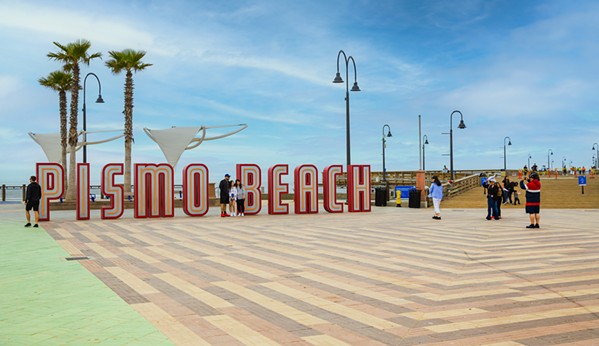
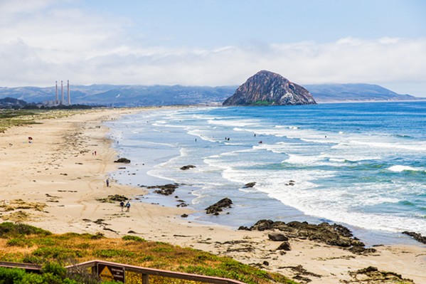
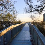
The wooden boardwalk above Moonstone Beach in Cambria. Point Buchon, which begins its windswept trek along coastal bluffs in Moñtana de Oro and makes its way between poppies onto PG&E's Diablo Canyon property. The wide strip of sand that runs from Pismo Beach through the Oceano Dunes State Vehicular Recreation Area. Surf Beach at Vandenberg Space Force Base.
Each plays a role in completing the grand vision that California has been chasing for at least half a century: building an interconnected trail system that runs the more than 1,200-mile length of the state's coast from Oregon to Mexico.
"Every segment is a really great segment, and we want more segments, and we want the general public to get out there and use it," said Linda Locklin, the California Coastal Commission's Coastal Access program manager. "The Coastal Trail is not a single thread. It is a multi-strand network trail."
Since she started her role with the commission in 1990, one of Locklin's tasks has been to help complete as many strands of that network as possible. The commission and three other state agencies are tasked with implementing the trail: Planning and permitting fall under the commission's purview, she said, the State Coastal Conservancy provides grants and helps facilitate funding from other entities, State Parks owns about 25 percent of the coast, and Caltrans is improving portions of the trail and building new segments as part of its projects.
The California Coastal Trail is roughly 70 percent complete, and filling in the remaining gaps is up to the state agencies, local governments, and nonprofits dedicated to the cause. Stitching the trail along the last 30 percent will require perseverance and planning.
Locklin said the two biggest impediments are funding and privately owned land.
"We don't have the money to build every segment of trail," she said. "The law says that if someone wants to develop their private property, they need to get a permit from the Coastal Commission. And through that process, the Coastal Commission has a right to ask for mitigation."
Those mitigation measures could include requiring public access to the coast and easements that enable trail building. Cities, counties, and nonprofits can also acquire privately owned land to construct trail segments—but both processes take time, often years, to complete.
Portions of the Central Coast's coastline will remain inaccessible to the public into the foreseeable future, such as Vandenberg Space Force Base between Point Sal and the Gaviota Coast north of Point Conception, as well as Diablo Canyon between Moñtana de Oro State Park and Point San Luis, and large stretches of Big Sur.
"There are areas that are really challenging and will take decades or more—and Big Sur is one of them, just looking at the topography there and the private ownership," Locklin said. "As opportunity comes up, we do our best in order to put in pieces of Coastal Trail."
Every piece, she said, is significant.
"It may be 100 feet long or it may be 300 miles long," Locklin said. "It provides an opportunity for anybody who wants to see and enjoy the coast, a place to walk and hike and sit on a bench to see our coastal property. It belongs to all of us."
The long game
As Locklin puts it, the state's been "working" on the trail for "a really long time."
In 1972, California voters passed Proposition 20, mandating that "a hiking, bicycle, and equestrian trails system shall be established along or near the coast" and "ideally the trails system should be continuous and located near the shoreline," according to californiacoastaltrail.org. The proposition established the California Coastal Commission, which the Legislature made a permanent state agency by passing the Coastal Act in 1976.
That act also emphasized the state's commitment to allowing the public to access the coast, preserving coastal habitat and agricultural lands, and prioritizing coastal recreation. This includes mandating local governments in the state's coastal zone to identify potential Coastal Trail alignments in their local coastal plans.
The trail gets highlighted more and more every decade, Locklin said. Legislation passed in the 2000s formalized the relationship between the commission, conservancy, State Parks, and Caltrans, including a 2007 bill from then Assemblymember John Laird.
Currently a state senator, Laird (D-Santa Cruz) has had the trail in mind for the duration of his time in public service, from the Santa Cruz City Council to the Legislature to being the state's secretary of natural resources.
"You always have hobbies, you always have two to three things in the background that you're always trying to move to the next step," he said. "This is like one of those projects."
During his time in office as a state senator, he aims to try to make as much progress as possible on different pieces of the Coastal Trail in his district, which includes Santa Cruz and San Luis Obispo counties and parts of Monterey and Santa Clara counties.
"So we've been working on it," Laird said. "I think California is a really special place, and we have to protect a Coastal Trail so we can protect it for generations to come."
A significant chunk is Big Sur. In a March 2022 letter Laird sent to the Big Sur Coastal Trail Working Group, he said that trail alignment through Big Sur was one of the issues he worked on as an Assembly member (2002 to 2008) that was still on the table when he was sworn into the Senate in 2020. Controversy over the trail alignment boiled down to a difference between what the Big Sur community wanted—a single track—and what state agencies envisioned—a larger network of trails.
"I am pleased to tell you that I believe we have a resolution," he wrote.
The proposed resolution includes two parts. The first: agreement on a single alignment of the trail. The second will involve discussion with the U.S. Forest Service (Los Padres National Forest) and some private property owners.
"We will have to work together to ensure that the necessary amenities, whether they be restrooms in certain locations, signage, mapping, collateral, and basic trail development, provide for the clarity and safety of the trail," Laird wrote. "Getting to an agreement on this issue is no small victory. ... [I] believe that this outcome is a good one for all local residents who have worked on this issue for so long."
While the resolution is a start, the trail through Big Sur still has a long way to go.
A connector that closes a gap between trail segments in Morro Bay and Cayucos is a little closer to reality. As part of Laird's budget priorities last year, he was able to secure $1.5 million for the Cayucos Land Conservancy to acquire 2,250 acres of land between the two SLO County towns. The land will create a new open space preserve for hiking, other recreation, low-cost camping, and trail connection to the beach.
Nick Franco, who recently retired from his post as the head of SLO County Parks and Recreation, said both the connector trail and the land acquisition are part of a larger project. The goals include building a safer bike route along but separate from Highway 1 that connects Morro Bay to Cayucos, allowing public access to and recreation in the canyon that once belonged to Chevron, as well as protecting open space along the coast from development.
What it takes
SLO County Parks and Recreation Planner Elizabeth Kavanaugh has spent 10 years working on the Morro Bay-Cayucos connector trail project. She said her predecessor also worked on it for about five years.
A 1.25-mile-long, 12 foot-wide, safe, multi-use strip of asphalt is slated to run from the North Point natural area on the north end of Morro Bay's beach, across Toro Creek along the dog beach and highway, and connect to Studio Drive in Cayucos. It will complete a 10-mile bike and pedestrian path—4 miles already exist in Cayucos and more than 5 in Morro Bay.
"It's going to be magnificent when it's built. Just the views and the vistas. It's crazy out there. It's so pretty," she said. "It will also be ADA accessible."
The longest and hardest part, she said, was acquiring the land to build the trail, which belonged to Chevron on the east and west sides of Highway 1. It's always the main hurdle to building trails, she added.
"We have to get permission from every single person who that trail traverses through. So getting all the landowners to say yes is a big, hard, long process," Kavanaugh said. "Getting the owners to be willing to have a trail on their site is a big, big challenge."
After completing an environmental impact report on the project in 2010, going through the federal environmental review process, applying for grants to fund the project, and coming to an agreement with Chevron, the county received a $7.4 million grant in 2022 from the California Transportation Commission to build the trail. It took coordination between the county, Caltrans, the city of Morro Bay, the San Luis Obispo Council of Governments, and other state and local agencies and nonprofits to get to this point.
"Having the land acquired and then having the money to construct really kind of lit a fire under the project. And now we're going through Coastal Commission review," Kavanaugh said, adding that she expects construction to start in late 2024/early 2025. "Believe it or not, that's a pretty good timeline to build trails."
Once complete, pedestrians could choose to walk on the beach that connects Morro Bay to Cayucos or on the paved pathway, and bicyclists will be able to travel safely between the two.
Tim Duff, a Coastal Trail project manager for the California Coastal Conservancy who focuses on the SLO County portion of the trail, said the connector trail is probably the most exciting project that's got funding and is heading to construction.
"I guess we could call it closing a gap in the Coastal Trail," Duff said. "That's super exciting."
Other opportunities, he said, lie within the State Parks system: Hearst San Simeon State Park has miles of shoreline on the west side of Highway 1. A 3-mile portion north of Piedras Blancas lighthouse is closer to Coastal Trail reality than the rest. As part of the realignment of Highway 1, Duff said, Caltrans and State Parks agreed to build a trail along the bluffs.
"They don't have the funding they need," Duff said of State Parks. "That's an opportunity that's been there for 15 years, and there hasn't been a whole lot done to open it up to the public. So we're working with them to get some funding."
He sees the Oceano Dunes State Vehicular Recreation Area as another opportunity. The park is tied up in litigation over a Coastal Commission decision that bans vehicles from the state park. Although people can currently walk the sand from Pismo Beach all the way to Point Sal, it's not necessarily safe. If vehicles can no longer drive on the beach, Duff said agencies could work together to improve public access—such as building restrooms, more parking areas and ingress from Highway 1, and boardwalk trails.
"The Coastal Trail encompasses all different types of trails, whether it be a sandy beach or an undeveloped bluff top or even an urban waterfront, those are all pieces of the Coastal Trail," Duff said. "While the goal is to string together a continuous 1,250 miles of Coastal Trail, for the typical visitor, they just want to be able to park their car on or near the beach, find a restroom, and enjoy a walk on the beach or blufftop."
Impediments
In southern Santa Barbara County, Caltrans is building restrooms, parking areas, and closing Coastal Trail gaps as part of a Highway 101 widening project. Caltrans District 5 Project Manager David Emerson said that it's a 10-mile corridor being widened in 2 mile chunks.
"And we're basically building sections of the Coastal Trail that align with what we're building," he said. "In some cases, we get the funding, design the trail, and build it. ... In some cases, the local agency takes over the design and build."
A good example, Emerson said, is the Santa Claus Lane bike path between Estero Street in Carpinteria and Sand Point Road in the county along the Salt Marsh Reserve on the coastal side of the highway for about a half a mile.
"It makes a big difference in the cyclists' experience. This allows them to take a dedicated Class 1 trail that is separated from the highway," he said. "It's all about just closing gaps."
He added that working in the coastal zone can be challenging. Not only do agencies have to contend with sensitive habitats and development restrictions, but topography can also be a barrier—not just to building trails but to maintaining existing trails.
"One of the major difficulties in maintaining trails along the coast is erosion and resource impacts," according to State Parks, which responded to questions via email. "As coastal erosion increases, trails are becoming closer to bluffs and drop-offs, causing safety and impact concerns."
State Parks, which also owns miles of coastline in southern Santa Barbara County, said that its properties can be remote and require "extensive logistics" to transport staff and material to project sites, which can impact the budget and construction schedule. The agency is also required to prioritize limiting impacts to cultural and natural resources.
"Identifying potential trail alignments to minimize or avoid these impacts can be difficult," State Parks said.
Santa Barbara County Trails Council Executive Director Mark Wilkinson said agreeing to maintain trails is often a caveat when working with State Parks to site new trails on its properties. Therefore, the council builds volunteer trail maintenance into its agreements with the state agency.
Wilkinson has spent the last decade pushing Coastal Trail priorities in the county, and while he's made progress in some places, such as the Santa Clause Lane bike path, he's run into walls in other places.
"In some ways, I think that San Luis Obispo [County] has done a much better job than us" in addressing trail gaps, he said.
Those walls include Vandenberg Space Force Base's 35 miles of coastline and about 20 miles of the Gaviota Coast, which runs on individual private property, such as at Hollister Ranch; Union Pacific property; and State Parks property. Vandenberg may never allow public access, but even for the properties not owned by the federal government, progress is slow, he said.
"It's not like it's not happening," Wilkinson said. "I usually say that 80 percent of the work is to get to the point where you're able to build the trail."
That 80 percent includes a lot of negotiation and relationship building.
In some cases, such as with Hollister Ranch, it also includes a regulatory nudge from the state. The long and litigious fight over public access at Hollister Ranch continues, but public access to the property seems inevitable thanks to state Sen. Monique Limón (D-Santa Barbara), whose bill requiring it to happen was signed into law in 2019. The Coastal Commission is currently working on an environmental review about what the impacts of that access and constructing Coastal Trail would entail.
Building the Coastal Trail, Wilkinson said, takes time—a long time—and also perseverance, collaboration, problem-solving, planning, and funding.
"You have to figure out what's possible," he said.

